Motivation
Growing up in the Midwest, all I knew was flat terrain, but I really loved being outside. I went to college in Michigan, and whenever I had free time during the summer or when I didn’t have to do homework, I’d regularly go on 50 mile bike rides to pass the time. Big mountains for me were 1,000 ft hills with 200 ft of incline, but I always wanted to try something bigger but never really had any plans.
Well into the pandemic, much like most millennials tired of staying home, I was starting to get the travel bug and wanted to go somewhere where I could challenge myself but also be rewarded at the end. Also, like most millennials, my partner and I would mindlessly let the Youtube algorithm pick which videos to watch on Youtube, which took us down some weird rabbit holes, from watching dermatologists remove blackheads to salivating over an Italian chef passionately cooking and eating freshly made pasta off the Almafi Coast.
During our Youtube binge, we came across the historic Mt. St. Helens volcano explosion back in the 80s. It looked so surreal, and both of us had never seen a volcano in person before and thought it’d be cool to see one up close. We were curious if we could hike up it and began our rabbit hole into what it was like to hike out in the Pacific Northwest. At first, we naively thought, “OK, let’s just get a pair of hiking boots and backpack for some snacks and water”. After a quick Google search, we realized this was a wee bit more than a hike in the UP.
This was not a walk in the park.
First, we needed to arrange for a permit (and hope to the mountain lords that the weather holds up on that day). Fortunately, it was early spring when we started conducting our research, and permits all came out for June in the beginning of May. The permit system was on a first come first serve basis in the morning, and we frantically refreshed the page the second the reservation opened up slots for the permits. Within one minute, only three days were left, and fortunately, we were lucky to have snagged one. Step 1 of 2000 complete.
Mt. St. Helens Climbing Permit
We started looking at what to expect. We went on AllTrails, and Google/Yelp for all things hiking. We didn’t want to do anything too “interesting” as it was our first big hike in the PNW. We saw the Worm Flows Trail was the most common route to the summit. It clocked in around 11 miles with 5,700 ft of elevation (round trip), probably equivalent to 6 months of using the Stairmaster for a Midwesterner like me packed into a day. Then we scrolled through all the pictures – very surreal with views of other large mountains in the distance, but most of them all had something in common, snow. We started looking at the pictures and reports in June, and snow, snow, snow.
Getting ready
The only thing we knew about snow and mountains was that we wouldn’t be able to just hike up with our hiking boots, especially if the gradient got steep and icy (to save you some time, yes, it was very icy towards the top). My partner had his hiking boots that he took everywhere and were very reliable, up to this point. We knew that before going on Mt. St. Helens, we couldn’t just use our hiking boots, but for the experienced hiker with good balance and surefootedness, it seemed like a pair of sturdy boots and some microspikes did the job.
Equipment:
- Sturdy mountaineering boots
- Crampons (a lot of people just used microspikes)
- Gaiters (glissading!) – garbage bag not recommended!
- Ice Axe
- Climbing Gloves
- 30L Hiking Pack & 3L Bladder
This was a big investment for us coming from the Midwest. Usually, all we’d need are a pair of sneakers/tennis shoes or hiking boots and a bottle of water. When we walked into an outdoor shoe store in Seattle, we showed them our hiking shoes and immediately told us these were not going to work with our crampons. As someone who really dislikes spending money, I was extremely skeptical of the salesperson, but once we were on the mountain, buying those boots probably saved us. We also recommend getting a crampon bag if you decide to buy crampons because those things are very sharp and will pierce right through a light backpack.
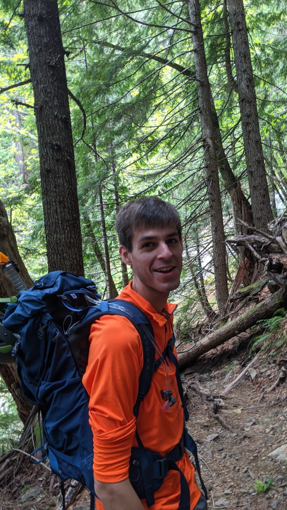
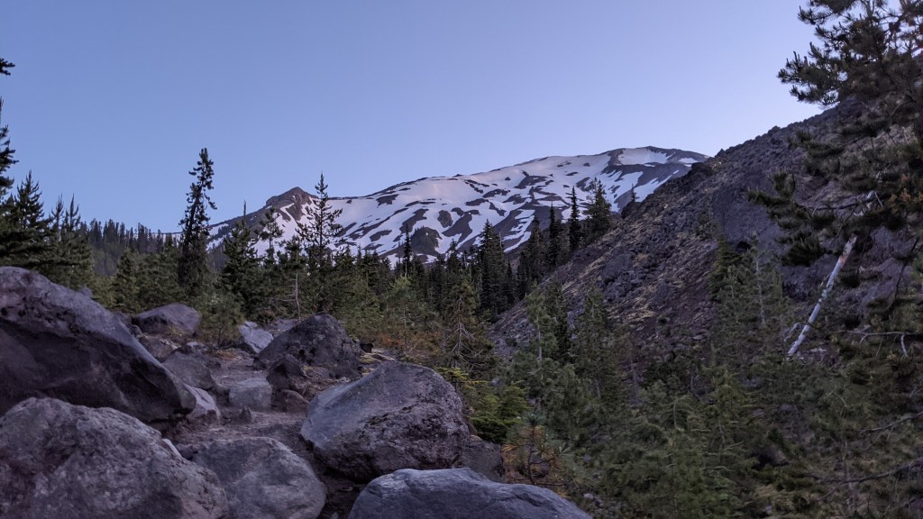
Our First Practice Hike: Mt. Dickerman (May 30, 2021)
Before trying out all the equipment on our big hike, we decided to go for a test run the day we bought all our equipment. We were really winging it and started pretty late (around 12:30), relying on the lovely experts on Youtube and forgetting about half the things we watched to figure out how to put on the crampons, self-arrest (we probably watched about 100 videos on this), and how to best use the ice axe going up for summer hiking.
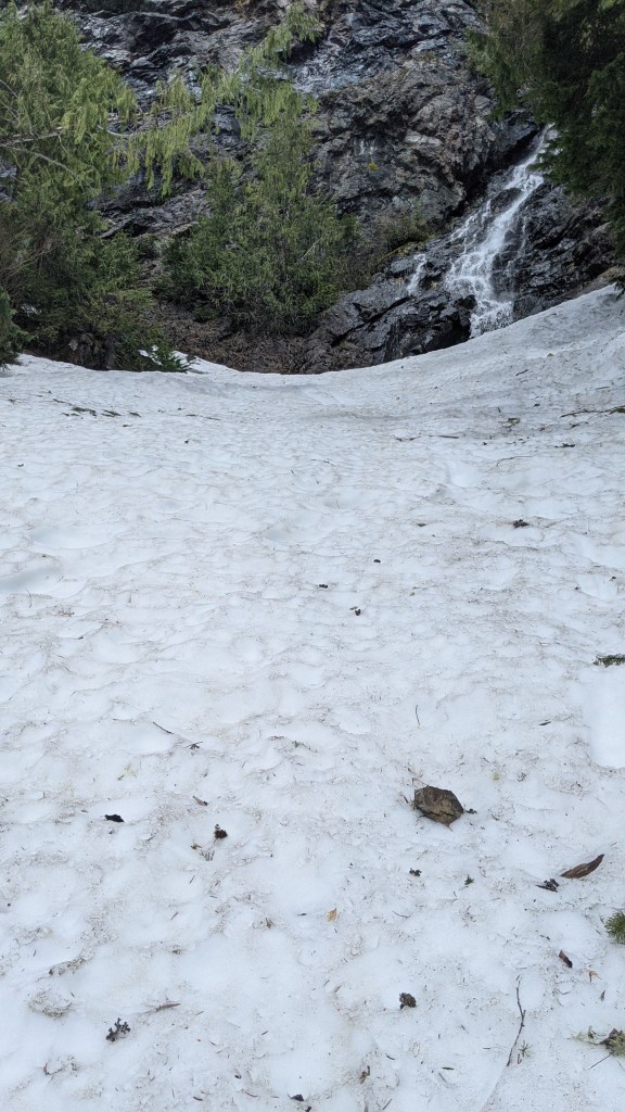
Given that these mountaineering boots are heavier than your ordinary hiking boot, the first few hours were a bit of a slog going through the wooded forest. However, we didn’t want to take the chance of our crampons falling off mid-hike because our boots were too flexible or accidentally stabbing our foot (yes, very gruesome). I’m glad that we did this hike because it really put our comfort zone to the test and allowed us to get some good usage out of our crampons.
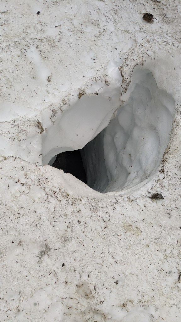
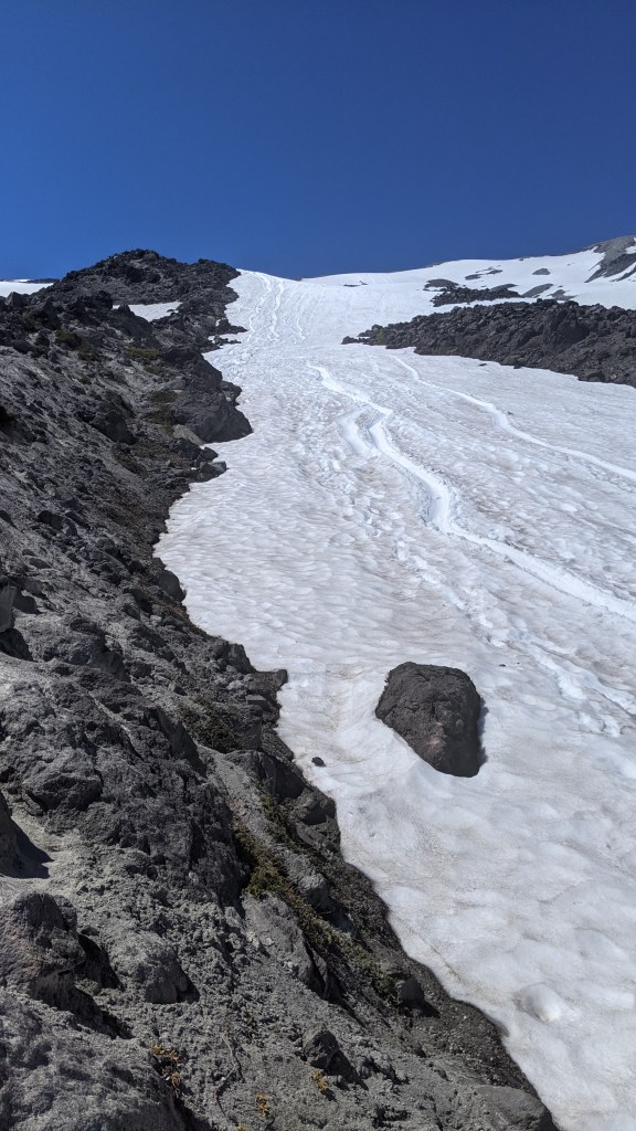
Once the snow started appearing, we were quickly met with having to trust our crampons on ice. After a couple steps, I knew these things were very study and would hold my grip in the snow. However, as a result of the overprotection, my legs were carrying a lot more weight, slowing down the hike. Here are a couple steep sections of snow we had to traverse, and why I’m glad we brought out the crampons.
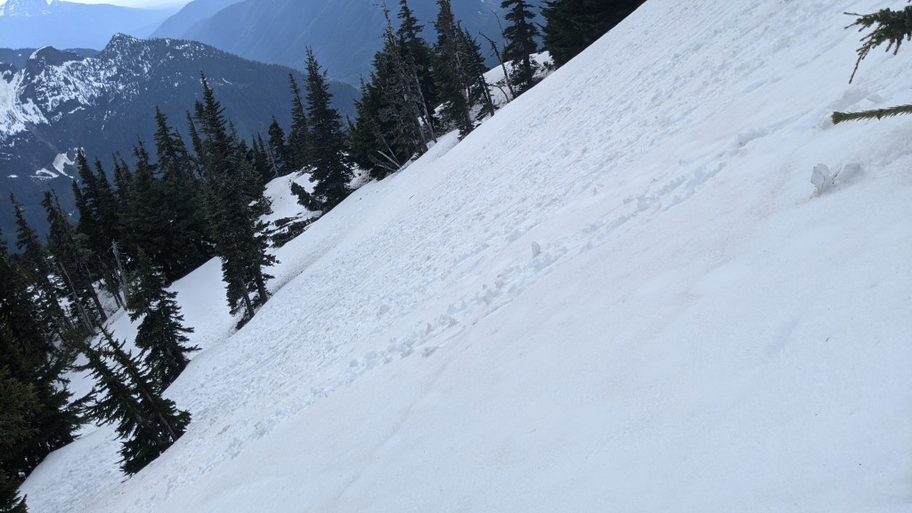
After several hours of hiking in 50-60F weather while we saw heaps of snow in June with mosquitoes and flies abound (weird…), we finally made it but decided against going into the cornice since it was probably a bit unstable at this time of year. Definitely challenging but manageable.
Mt. St. Helens: June 19, 2021
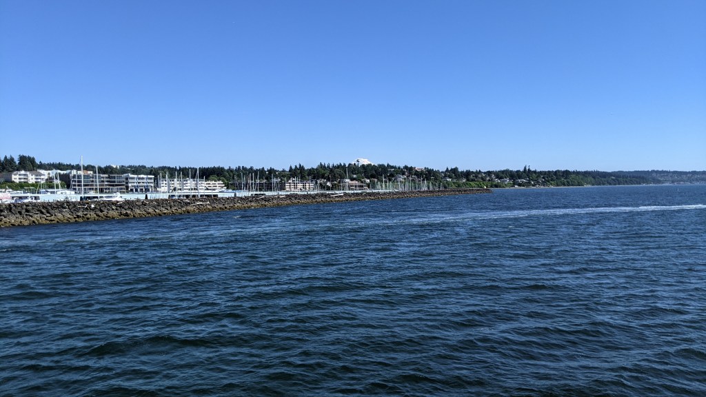
Writing this over a year after the trip, sometimes I wonder how we even survived all this. On Friday, June 18th, we were walking from the airport (SEA) to Hertz when a lovely lady also happened to be going for a walk. We were right next to a forest preserve, and she told us since we had some time to kill, we should go for a walk in the forest with her, which led us to Des Moines (not in Iowa!), right along the coast. We were cautious at first, but she was really good company and helped us kill off a couple hours before our drive down to Mt. St. Helens. It was really pretty and a great way to relax the day before the big hike.
After she dropped us off, we went to Hertz to pick up our car. They gave us an “upgrade” to a Nissan Armada, which was just a humungous beast of an SUV, which while smooth, was a huge gas guzzler and really difficult to turn (my partner took up 3 lanes of fairly busy traffic trying to make a turn, pretty stressful). We then went straight to Mt. St. Helens to sleep in the trunk. My partner was pretty tired at this point and given it was dark with lots of winding roads, he was just rushing to get straight to the parking lot. Once we were there around midnight, suffice it to say, we had a total of about 30 minutes of sleep that night, if that at all.
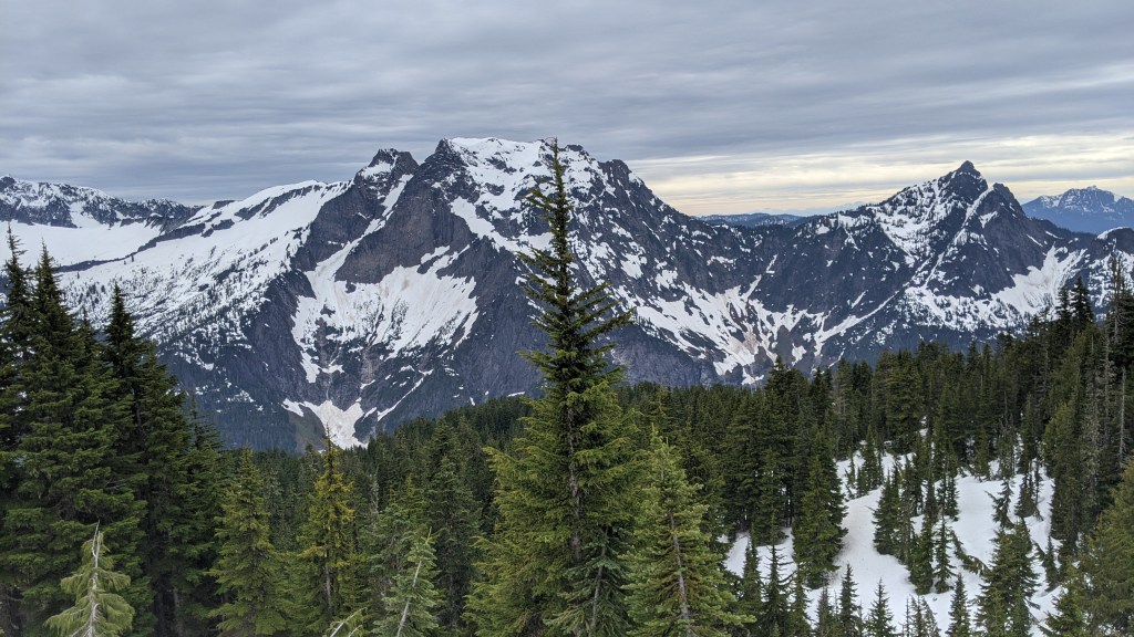
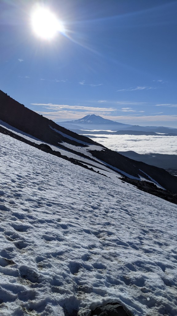
We started around 3AM. A lot of the hiking began in the forest, and once we started hitting daybreak, we finally saw what we were up against and why it was called the “Worm Flows Trail”. Luckily, the views were honestly amazing the whole way up from there, seeing several rock formations left from the eruption.
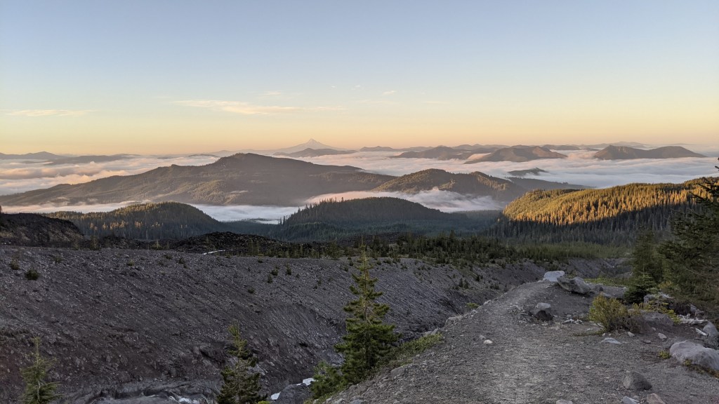
We got to see a lot of other cool mountains in the distance as we were approaching Mt. St. Helens, and it was really cool to see the clouds so low hovering below the mountains.
Once we finally got to the mountain, the sun was fully shining and we were starting to see patches of snow and rock. The one thing we totally didn’t take into account was the amount of sand/silt that would be blowing into our faces the whole way up as there were patches of rock/exposed sand throughout. I wouldn’t have minded a mask when I saw the cloud of sand coming right at us. Suffice it to say, my water bladder, nose, and teeth were filled with small black sand particles.
Once we realized we needed our crampons, we were already pretty exhausted, either from the sun or having already gone up 3000+ ft of elevation at this point. We noticed that the mountain was only getting steeper from here, and at the point we were ready to put on our crampons, we had to fight a little bit for our balance and facing down the mountain was honestly a little frightening. We actually were discussing whether or not we should turn back at this point given we were pretty slow (my partner (who is writing this post) slowed down the pace since he/I was not at the aerobic capacity as Joe). However, we thought we were close enough and decided to trudge on.
The last hour or two going up the summit was a true trudge as the snow got steeper and one of Joe’s crampons started to loosen up a bit and he wanted to just get up to a point that was as flat as possible.
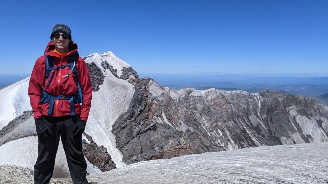
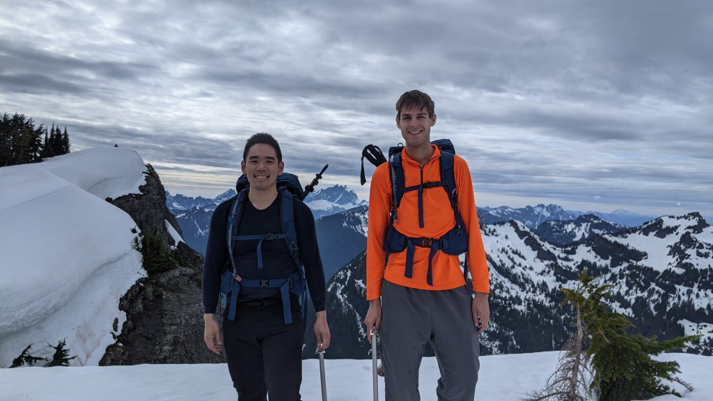
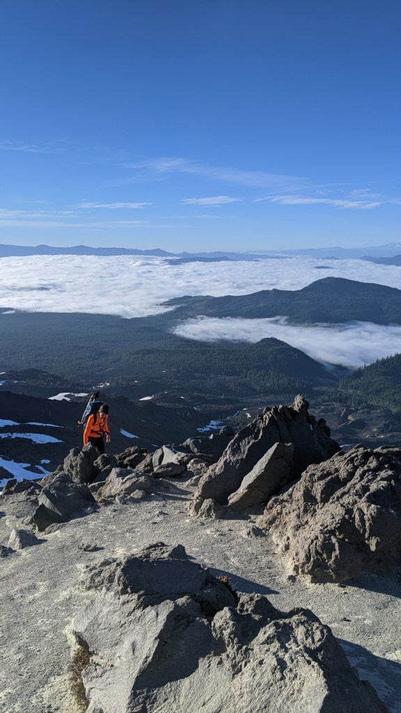
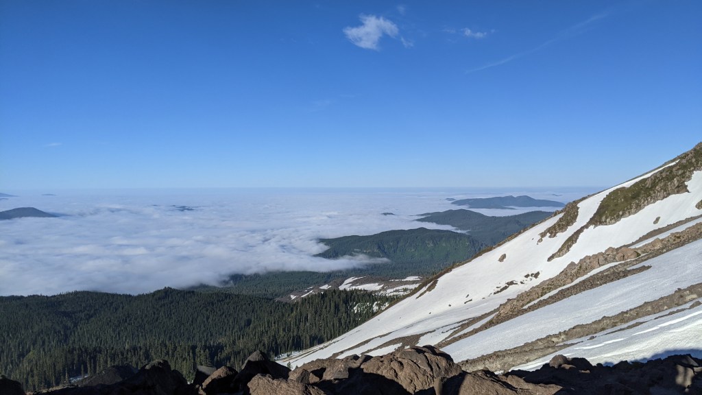
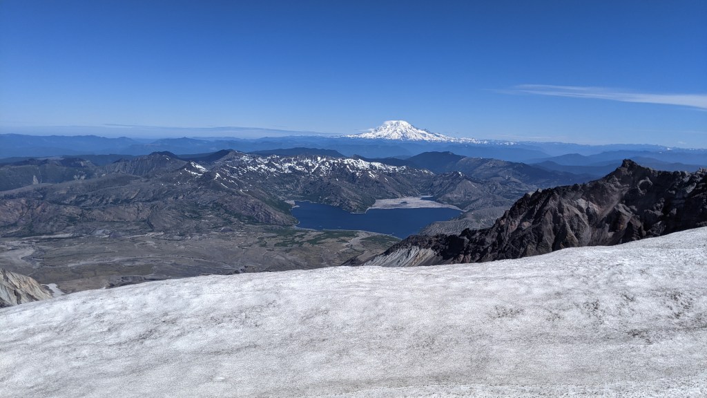
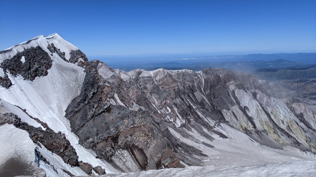
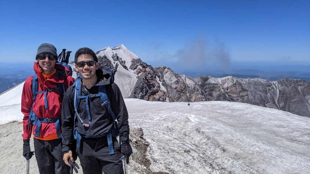
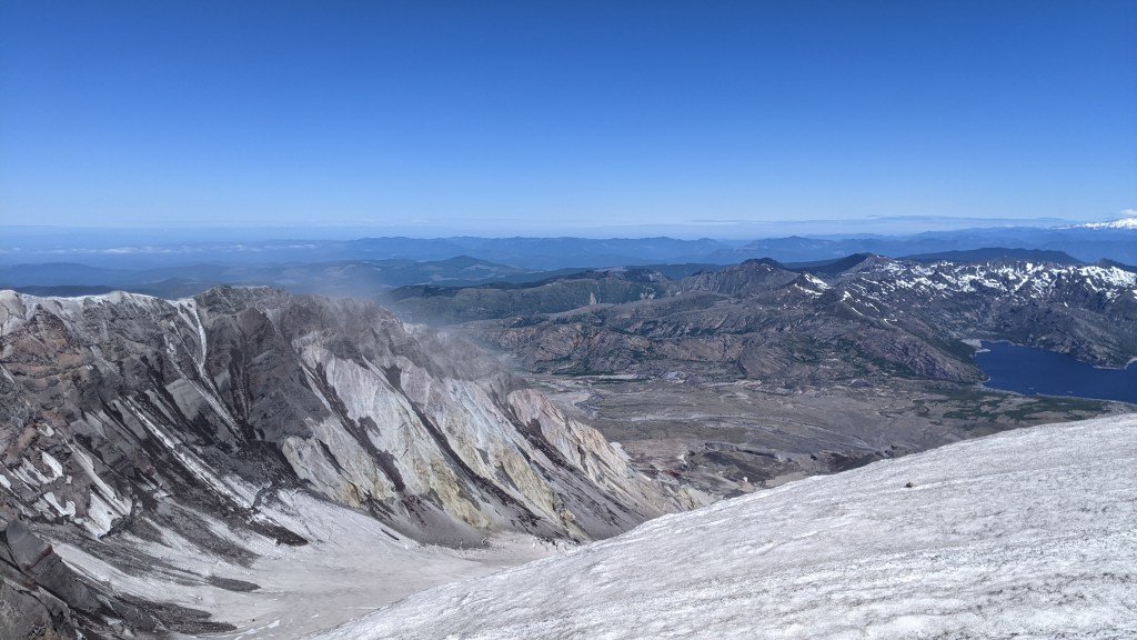
Summit Pictures
The summit was absolutely breathtaking and it was really cool to see the other side. We technically did not make the summit, but given it was the beginning of summer, the cornice at the true summit was not stable (2nd picture on the left in the true summit), and not many people if any at all attempted to reach the true summit. In the distance in the first picture, you could still see the tree logs in the lake (first picture) in the distance, which I assume was from the aftermath of the volcano. After seeing the effect of this volcano, it only made me appreciate how powerful mother nature could be and that we should never underestimate its potential.
Going back down
After spending at least half an hour at the top, we made our way down and wanted to make it as efficient as possible since we were exhausted at this point. We decided to try our hand at glissading and got out our gaiters to make sure we didn’t completely soak ourselves. It was a lot of fun and saved a lot of time, but my partner being a bit heavier had an easier time going faster, but he definitely felt at times that he was going too fast but in reality probably wasn’t going more than 10mph. There were a couple times when we had to double check which way we were going down since there were multiple routes that would take us to different parking lots and make sure we weren’t heading over a cliff. The general rule was for us was that if we couldn’t see past the horizon we stopped at least 50 ft before.
By the time we got back, we were absolutely exhausted but felt really rewarding to have not given up. We had to take a pit stop on the way back to Seattle, where my partner literally passed out within 15 seconds of parking and woke up 3 hours later, at around 11pm. We eventually made it to our hotel in Seattle and slept like babies.
